Here's what the sea surface temperatures look like now (these are anomalies in degrees C):

The SSTs respond to the dynamics that spent quoted, but they help dictate the weather here (pacific northwest). You can see anomalously warm water right over the equator indicating that the trades are dying down, which enables El Nino to deepen. One of the interesting things about the SSTs right now is the prevalence of warm anomaly all over the Northern Pacific.
Here's the full blown La Nina from Jan '08:

See the difference?
Here's the map from one of the strongest El Ninos on record '97-'98

Pretty dramatic. The eastern tropical pacific almost looks angry.
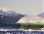
The best part is that Vancouver 2010 is happening this winter with a lot of events on the north shore mountains that simply don't get snow during warm winters (think ski bowl). I think events in whistler will be okay since all the downhillers need is a thin layer of icy snow. But, it could get ugly.
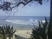
For surf, the warmer equatorial temperatures of an el nino can help keep a storm track alive in the northern pacific giving us a little more swell than usual and helping to keep the nuking north winds somewhat at bay. This winter expect lots of warm rain (pineapple expresses) and WSW swell (bad year for the strait). Of course, it's weather leaning toward climate so any predictions are probably wrong.